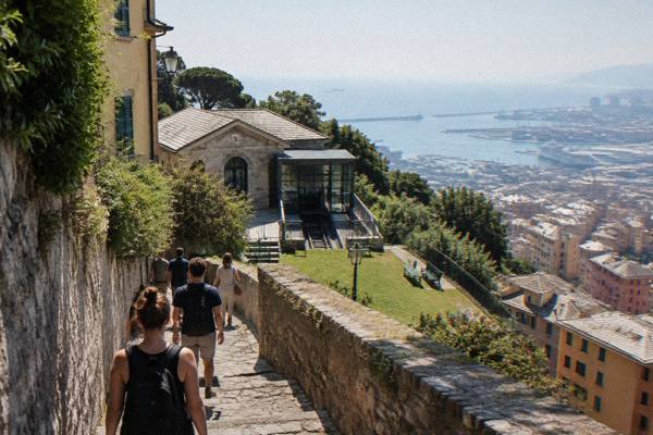
Hiking Near Genoa: Portofino Promontory, The Forts And Coastal Paths
Genoa sits between the Ligurian Sea and the Apennine hills, which means hiking country starts at the edge of the city itself. This guide covers the forts above the old town, the Portofino promontory, the Camogli to San Fruttuoso path and the coastal walks at Nervi, with the fares, distances and season facts needed to plan each one.
Short answer
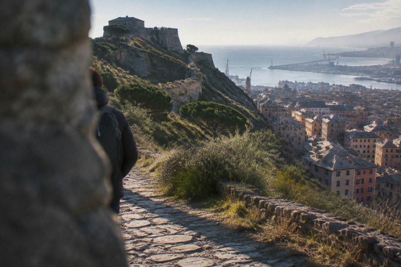
The closest hiking to Genoa is the Parco delle Mura forts circuit above the city, reached with a 2.00 EUR AMT ticket or the Zecca-Righi funicular; the Portofino promontory, Camogli and San Fruttuoso lie 18 to 25 km away by straight line and are reached by train or boat; the official 1971-2000 normals for Genoa Sestri put October rainfall at 171.3 mm, so spring and summer are the drier windows for the coastal paths.
Genoa is a coastal city in Liguria, north-west Italy, wedged between the Ligurian Sea and the Apennine hills, and that geography is the whole reason hiking here works: the high ground begins at the back of the neighbourhoods, and the marked paths of the Portofino promontory and the Ligurian coast sit within a short train or boat ride of the centre. The city itself holds the Parco delle Mura, a ring of fortifications above the old town that the Genoa Travel Guide covers as a sight in its own right on the Parco Delle Mura And Forts page, and from those ramparts the trail network runs out east towards Nervi and south-east towards the promontory. This guide sets out, for each area, the straight-line distances, the public-transport fares that apply, the boat services that link the coastal paths, and the official climate normals that decide which months suit a long walk. Reported figures are attributed, and where an operator sets the detail it says so on its own listing.

Where Can You Hike Near Genoa Without A Car?
The main car-free hiking areas around Genoa are the Parco delle Mura forts circuit directly above the city, the Passeggiata Anita Garibaldi and the Parchi di Nervi about 9 km east, and, further out, the Portofino promontory and the Camogli to San Fruttuoso path, about 25 km and 22 km from Piazza De Ferrari by straight line. All of them are reachable by AMT public transport, by regional train or by boat, and none requires a car.
Portofino in particular is a limited-traffic zone where non-residents park in a paid car park reported at about 8 EUR an hour, which is one more reason to arrive on foot or by water.
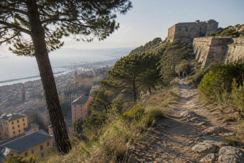
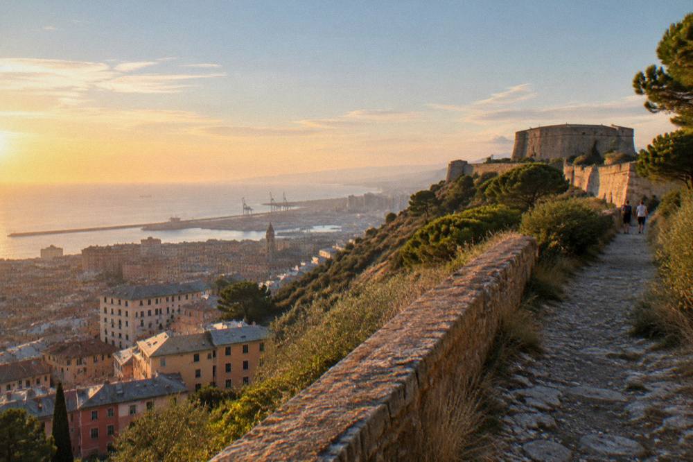
The Parco delle Mura is the nearest proper hill walking to the centre. The park takes its name from the city walls and the fortifications built along the ridge, and the Zecca-Righi Funicular gives the quickest lift into that high ground: it runs daily from 06:40 to 24:00, according to the AMT Genova funicular page, and an ordinary urban ticket covers it. AMT also runs 14 public lifts across the city, and the Castelletto Levante lift from Piazza Portello to the Spianata Castelletto runs the same daily hours. The fare logic matters for a hiking day, because a single ticket is not the only option and the multi-ride choices change the arithmetic:
| AMT Ticket Or Pass | Price | What It Covers |
|---|---|---|
| Ordinary single | 2.00 EUR | 110 minutes on the whole Città Metropolitana network |
| AMT + Trenitalia integrated | 2.20 EUR | 110 minutes including limited Trenitalia segments |
| 5-hour ticket | 5.00 EUR | Five hours on the urban network |
| Carnet of 11 singles | 20.00 EUR | Eleven 110-minute tickets |
| Met Daily 24h | 10.00 EUR | Full AMT network for 24 hours, including Volabus and line 782 to Portofino |
| Lift or Sant'Anna funicular ride | 1.20 EUR | One ride on a public lift or the Sant'Anna funicular |
The Met Daily deserves a second look from hikers, because the AMT Volabus page confirms that it is valid on line 782, the Santa Margherita Ligure to Portofino bus, and on the Volabus airport service. That makes it the one ticket that carries a walker from a flight or a city hotel to the edge of the promontory trails and back.
Nervi is the second near-city option. The Passeggiata Anita Garibaldi is a cliff-top seaside promenade of about 2 km running from the Nervi harbour to Capolungo, per the official tourism site, and the Parchi di Nervi cover 9.2 hectares between Via Aurelia and the sea, with a rose garden holding more than 200 varieties and roughly 100 botanical species. Reaching it is simple: Genoa Nervi station sits next to the promenade. Anyone tempted to swim after the walk should check the ARPAL classification first, because the 2026 bathing-water report is what grades each point on the Ligurian coast.
What Are The Forts Of Genoa And How Do You Reach Them?
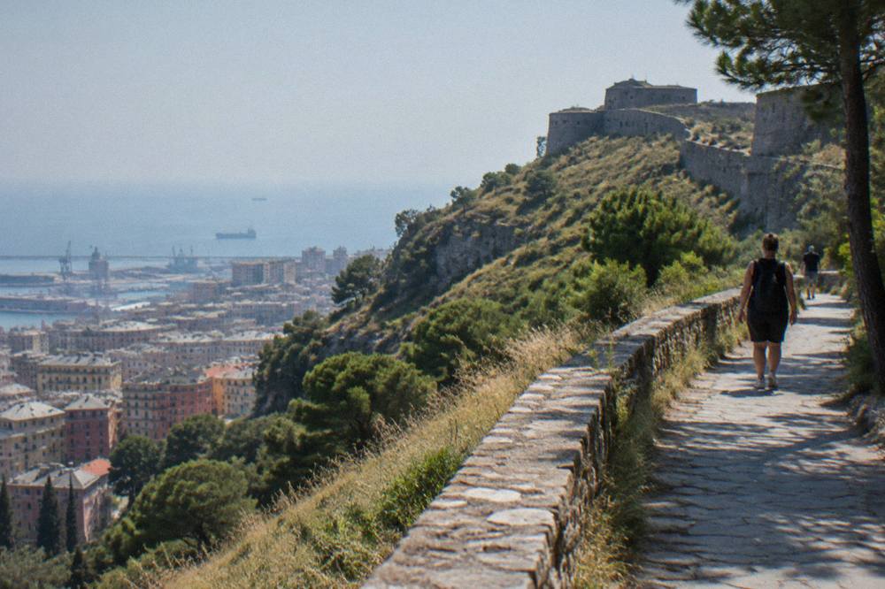
The forts above Genoa are the fortifications of the Parco delle Mura, a circuit of walls and fortified points ringing the ridge behind the city, reached from the centre by the Zecca-Righi funicular, by AMT bus or on foot from the Spianata Castelletto lift, all covered by the ordinary 2.00 EUR ticket valid 110 minutes, or by the 1.20 EUR single ride on the lifts and the Sant'Anna funicular. The funicular runs daily 06:40 to 24:00.
The park itself should be confirmed locally before an after-dark section of the circuit.
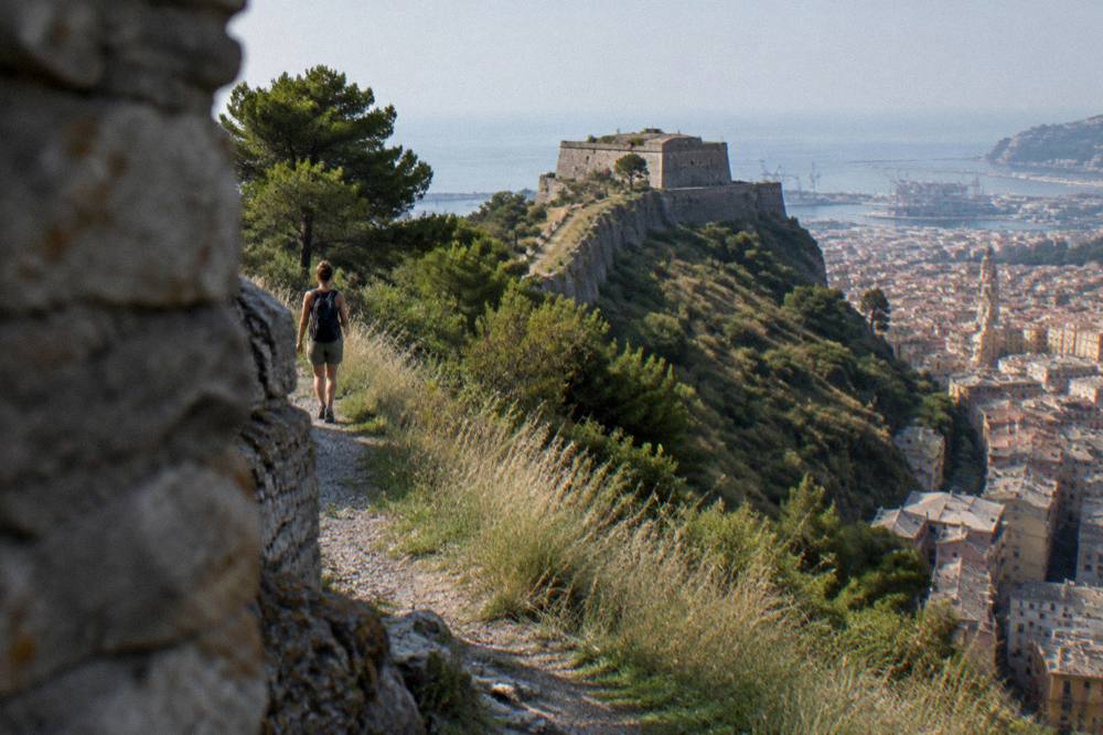
The value of the forts circuit for a visiting hiker is that it delivers ridge walking with sea views without leaving the city transport zone. The funicular climbs to the upper station in about 12 minutes across 7 stations, per the AMT page, and from the top the paths of the Parco delle Mura connect the wall segments and the fort platforms. The full detail of the circuit and the individual forts is on the Parco Delle Mura And Forts page.
Because the circuit starts high, the descent finishes in the city, which pairs naturally with a recovery afternoon low down. The Aquarium of Genoa, open 365 days a year with adult fixed-date tickets from 26.00 EUR and under-4s free, per the Aquarium's own ticket page, is the standard wet alternative, and the Genoa Aquarium Tickets guide covers the pricing in full. Anyone planning several museums around a walking trip should compare the Genoa Museum Card, which at the 2026 rates costs 24 EUR for 24 hours and 45 EUR for 48 hours and covers 28 city museums.
A guide also helps with the city's vertical logic before the walking begins. The rickshaw tour of the city, linked above, covers the historic centre from a seated position and suits the day before a long hike, and the same operator's listing carries the current price and availability.
How Do You Walk The Portofino Promontory Trails From Genoa?
The Portofino promontory, about 25 km south-east of Piazza De Ferrari by straight line, is walked from bases at Camogli, San Fruttuoso, Portofino and Santa Margherita Ligure, and from Genoa it is reached by regional train along the coast, by the Golfo Paradiso Two Gulfs boat tour from Porto Antico on listed dates, or by AMT line 782 from Santa Margherita with the Met Daily ticket. Portofino itself is a limited-traffic zone, so the walk, the train or the boat is the practical way in.
Non-residents who do drive park at a car park reported at about 8 EUR an hour.
The boat option is unusually well documented. The Golfo Paradiso Two Gulfs tour departs Genoa Porto Antico at 11:00 and calls at Camogli at 11:45, with crossings of about 30 minutes from Camogli to San Fruttuoso and again from San Fruttuoso to Portofino, on listed dates from March 2026. Reported fares are about 29 EUR for the full day and 21 to 26 EUR for a half day, and the operator's own site holds the calendar. Camogli sits about 18 km from Piazza De Ferrari by straight line, San Fruttuoso about 22 km, Santa Margherita Ligure about 24 km and Portofino about 25 km.
The promontory pairs with a classic question: is a boat ride from Genoa to Portofino even possible? The Can I Take A Boat Ride From Genoa To Portofino? answer covers it, and the wider comparison between the two places is on the Genoa Or Portofino page and the Genoa To Portofino guide. For a structured day on the water rather than a self-planned crossing, the Portofino Boat Tour From Genoa page sets out the options.
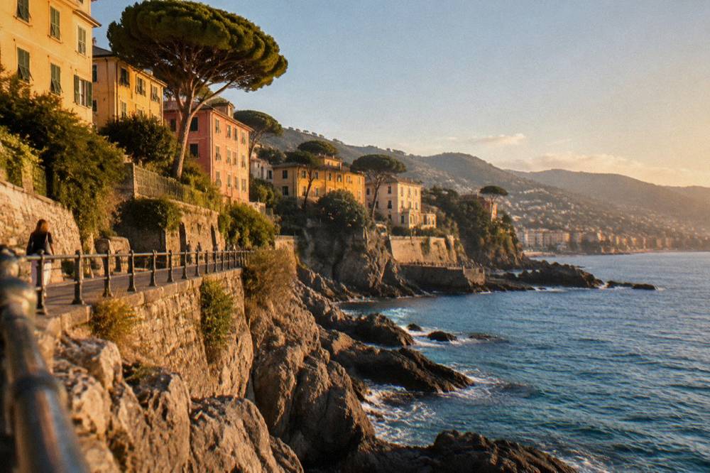
San Fruttuoso adds a fixed entry figure to the day. The abbey there is a FAI property, and its visit page lists full entry at 10 EUR, ages 6 to 18 and students to 25 at 5.00 EUR, under-5s free and a family ticket at 26.00. Opening follows the seasons:
| Period | San Fruttuoso Abbey Hours |
|---|---|
| January and February | Daily except non-holiday Mondays, 10:00 to 15:45 |
| March | 10:00 to 15:45 |
| April and May | 10:00 to 16:45 |
| June to mid-September | 10:00 to 17:45 |
The abbey closes when boat access is suspended, so the weather call and the entry call are the same call on this coast.
Can You Hike From Camogli To San Fruttuoso?
Camogli to San Fruttuoso is the best-documented coastal walk of the area, because the Golfo Paradiso boat service between the two runs year round from Camogli, which means the walk can be done one way and the return made by water, with Camogli about 18 km and San Fruttuoso about 22 km from Piazza De Ferrari by straight line, and with the abbey entry at 10 EUR full price and the Two Gulfs boat connection from Genoa calling at Camogli at 11:45 on its listed dates.
The practical shape of the day is what makes this route stand out. The Camogli to San Fruttuoso boats run year round, with an additional Recco service from April to September, per the operator's line page. That gives a walker a bail-out at the far end in every season. Recco itself, about 17 km out, is the home of focaccia di Recco, which has been an IGP product since 2015 and is made only in Recco, Camogli, Sori and Avegno, reported by the local tourism source, which makes the circuit a food walk as much as a trail walk.
From San Fruttuoso the Servizio Marittimo del Tigullio opens the rest of the coast. Its lines, per the operator, run from Rapallo through Santa Margherita to Portofino and San Fruttuoso (line 1), from Sestri Levante through Lavagna and Chiavari to Portofino and San Fruttuoso (line 2), and from Santa Margherita and Rapallo to the Cinque Terre (line 4). Fares on those lines should be checked on the operator's own site before relying on one. The Cinque Terre themselves lie about 67 km from Genoa by straight line, and their card system is separate:
| Card | Price | Notes |
|---|---|---|
| Cinque Terre Treno Card, 1 day | 22.00 to 35.00 EUR | Varies by date band |
| Cinque Terre Treno Card, 2 days | 36.50 to 61.00 EUR | Varies by date band |
| Cinque Terre Treno Card, 3 days | 49.00 to 81.00 EUR | Varies by date band |
| Trekking Card | 10 EUR standard, 15 EUR peak | Reported price |
Before the long coastal days, the city itself rewards a guided orientation, and the private historical tour linked above is one way to get it.
What Are The Creuze And The Urban Paths Of Genoa?
The creuze are the historic mule paths that link the Genoa waterfront to the hills above the city, so walking them is hiking inside the city boundary. The paths climb from the coast into the Parco delle Mura ground, and because the city is stacked, the AMT public-lift network of 14 lifts plus the Sant'Anna funicular, at 1.20 EUR a ride, lets you plan a creuze walk uphill on foot and downhill by lift.
The panoramic tour across the creuze appears in this site's tour roster as a guided option, and it frames what the paths are: the old connections between the port economy and the terraced high ground. The authorless rule holds here as everywhere: the account follows what the listings and the transport authority say, not a walk anyone took. What the sources give for the vertical city is concrete and useful:
| Vertical Transport | Hours | Fare |
|---|---|---|
| Zecca-Righi funicular | Daily 06:40 to 24:00 | Urban ticket or 1.20 EUR vertical |
| Castelletto Levante lift | Daily 06:40 to 24:00 | 1.20 EUR vertical |
| Sant'Anna funicular | Daily about 07:00 to 00:30 | 1.20 EUR |
| Montegalletto lift | Weekdays about 07:10 to 19:50 | 1.20 EUR |
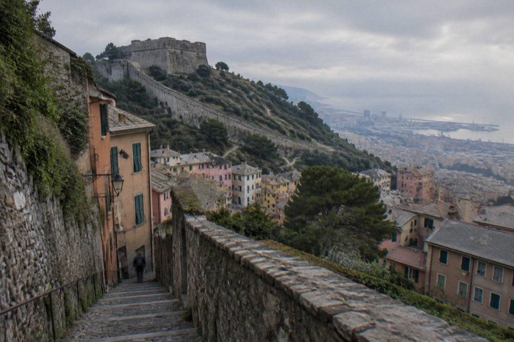
The creuze also connect to the city's story. The old town below them covers 113 hectares and is described by the official tourism site as one of the largest medieval historic centres in Europe, and the UNESCO property of the Strade Nuove and the Palazzi dei Rolli, inscribed in 2006 with 42 palaces, sits at the top of the same slope. A day that climbs a creuze in the morning and walks Via Garibaldi in the afternoon covers five levels of the same hillside.
When Is The Best Season For Hiking Near Genoa?
The official 1971-2000 normals for Genoa Sestri put July rainfall at 24.2 mm and October rainfall at 171.3 mm, with mean daily highs of 27.3 C in July and 27.7 C in August against 20.0 C in October, so the drier walking windows around Genoa are the late spring and summer months, and October is also when the autumn Forts-season events such as the Rolli Days, 16 to 18 October 2026, fill the city itself.
The full normals, from the Aeronautica Militare climate atlas for the Genoa Sestri station, tell the seasonal story better than any generalisation:
| Month | Mean High C | Mean Low C | Rain mm |
|---|---|---|---|
| January | 11.5 | 5.5 | 101.8 |
| February | 12.2 | 6.0 | 74.0 |
| March | 14.6 | 8.2 | 81.7 |
| April | 16.8 | 10.5 | 88.0 |
| May | 20.5 | 14.2 | 72.4 |
| June | 23.9 | 17.6 | 58.2 |
| July | 27.3 | 20.9 | 24.2 |
| August | 27.7 | 21.0 | 69.3 |
| September | 24.4 | 17.9 | 136.4 |
| October | 20.0 | 13.8 | 171.3 |
| November | 15.1 | 9.2 | 108.8 |
| December | 12.5 | 6.5 | 93.1 |
Two practical readings follow. First, the summer months carry the highest mean highs but the lowest rainfall, and the coastal paths hold sea breeze that the inland grid does not record; the temperature normals here are station normals, not the ERA5 reanalysis, which runs cooler and is not used for temperature on this site. Second, September and October together bring the heaviest rain of the year at the Sestri station, and October's 171.3 mm matters for boat-dependent walks: the San Fruttuoso abbey closes when boats suspend, and the Two Gulfs tour runs on listed dates only.
Season planning should also look at what else the calendar does to the coast. The Genoa Weather guide holds the full climate picture, the Best Time To Visit Genoa page weighs the months against the city's rhythm, and anyone stretching a hiking trip into a longer stay can build it around the Genoa In Three Days itinerary.
The rickshaw tour above is this site's featured pick for the day before the trails: it covers the historic centre in the saddle while the legs are still fresh, and its listing carries the live price and dates. Readers who prefer to check it directly can also Check availability before committing the itinerary.
What Should You Pack And How Do Tickets And Boats Fit Together?
A hiking day around Genoa needs the AMT fare logic (a 2.00 EUR single valid 110 minutes, a 10.00 EUR Met Daily for 24 hours including line 782 to Portofino, or a 1.20 EUR lift ride), boat contingency at San Fruttuoso where the year-round Camogli service allows a one-way walk, the abbey entry of 10 EUR full price if the walk ends there, and a rain plan built on the fact that October averages 171.3 mm of rain at the Sestri station.
The Aquarium, open 365 days with adult tickets from 26.00 EUR, is the fixed indoor fallback when the rain arrives.
Packing follows the terrain, not the latitude. The paths here are Mediterranean: stone, scrub and exposed ridge, with the forts circuit and the creuze adding steep steps inside the city. Water discipline matters in July and August, when the station normals show mean lows above 20 C, meaning nights that do not cool the trails much. No sea-temperature figure is printed on this site, and swimming quality varies by point: ARPAL's 2026 report grades Boccadasse as SCARSA and Nervi as BUONA, out of 380 sampling points on the Ligurian coast classed Eccellente, Buona, Sufficiente or Scarsa.
The ticket-and-boat combination deserves its own table, because the pieces interact:
| Situation | What To Buy Or Book | Figure |
|---|---|---|
| City forts and creuze day | AMT ordinary ticket or Met Daily | 2.00 EUR / 10.00 EUR |
| Lift-assisted descent | Vertical single on lifts or Sant'Anna funicular | 1.20 EUR |
| Portofino promontory from Santa Margherita | Met Daily, valid on line 782 | 10.00 EUR |
| Genoa to Portofino by sea on listed dates | Two Gulfs tour, full day | About 29 EUR, reported |
| Camogli to San Fruttuoso return bail-out | Golfo Paradiso boat, year round from Camogli | On the operator's site |
| Cinque Terre trails and trains | Cinque Terre Treno or Trekking Card | 22.00 to 35.00 EUR 1-day, or 10 EUR trekking |
The three options above close the loop for a hiking-centred trip: a guided ride through the city, a private boat day on the promontory coast, and a private historical walk for the evening the legs need a rest. Each listing carries its own price, rating and calendar.
Where Should You Stay To Mix Hiking And The City?
The practical base for hiking around Genoa is the city itself, because the trains, the AMT network and the Porto Antico boats all radiate from the centre. The tourist tax set by the comune is 2.00 EUR per person per night in 1-star hotels, 2.50 EUR in 2-star and 4.00 EUR in B&Bs, charged on the first 8 consecutive nights, a small and knowable extra cost on top of the room.
Reported rates for 3 to 5-star properties run from 3 to 5 EUR per night.
The Where To Stay In Genoa guide covers the districts. What the hiking planner adds is the transport-side argument: Genova Piazza Principe and Genova Brignole anchor the regional lines towards Camogli, Santa Margherita and the Cinque Terre, the metro runs 7 km with 8 stations from Brin to Brignole, and the airport sits about 7 km west of Piazza De Ferrari with the Volabus connection to Principe, De Ferrari and Brignole in about 30 minutes under the 10.00 EUR Met Daily. Arrival logistics are on the How To Get To Genoa, Genoa Airport and Milan To Genoa pages, and cruise arrivals planning a walking day ashore should start at Genoa Cruise Port.
Common Questions About Hiking Near Genoa
Can You Hike Directly From Central Genoa?
Yes. The Parco delle Mura forts circuit and the creuze start at the edge of the built-up city, reachable with the 2.00 EUR AMT ticket or the Zecca-Righi funicular, which runs daily 06:40 to 24:00.
How Far Is The Portofino Promontory From Genoa?
Portofino lies about 25 km from Piazza De Ferrari by straight line, Camogli about 18 km and San Fruttuoso about 22 km, all reachable by regional train, by boat from Porto Antico on the Two Gulfs dates, or by line 782 from Santa Margherita Ligure under the Met Daily ticket.
What Is The Wettest Month For Hiking Near Genoa?
By the official 1971-2000 normals for Genoa Sestri, October has the highest monthly rainfall at 171.3 mm and July the lowest at 24.2 mm.
Can You Swim After A Coastal Walk Near Genoa?
Swimming quality varies by point. ARPAL's 2026 classifications report Boccadasse as SCARSA and Nervi as BUONA, and the network covers 380 sampling points on the Ligurian coast.
Do You Need A Car For Hiking Around Genoa?
No. The forts, Nervi, the promontory and the Camogli to San Fruttuoso walk are all served by AMT transport, regional trains and boat services, and Portofino is a limited-traffic zone where non-residents park at a reported 8 EUR an hour.
Is The Camogli To San Fruttuoso Boat Available Year Round?
Yes, the Golfo Paradiso service from Camogli runs year round, with the Recco departure running April to September, so the walk can be done one way with a boat return.